Levé topographique
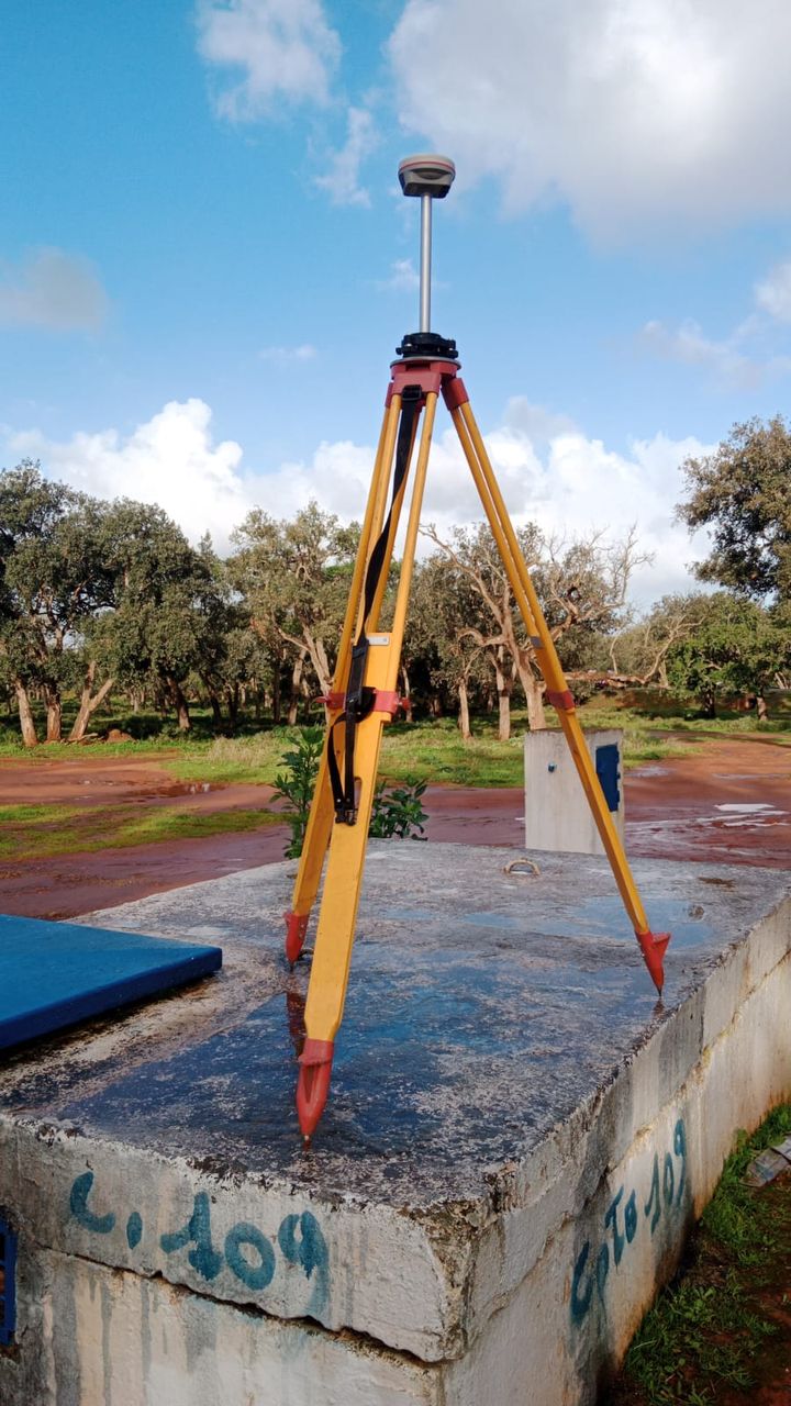
Levés de terrain à la station totale, au GPS/GNSS et au niveau, pour plans de situation, plans cotés et implantation de bornes.

Plans cotés, MNT, courbes de niveau, profils en long et surfaces : directement dans ton navigateur.
BoukaTopo est conçu par Azddine El Bouk, technicien spécialisé géomètre-topographe (ISTA Témara) et chef de brigade, avec plus de dix ans d'expérience sur des projets d'infrastructure : port Nador West Med, ligne ferroviaire à grande vitesse, barrages, ouvrages d'art et travaux cadastraux.
Levés de terrain à la station totale, au GPS/GNSS et au niveau, pour plans de situation, plans cotés et implantation de bornes.
Prise de vue aérienne par drone, restitution photogrammétrique, suivi de chantier et calcul de volumes (carrières, terrassements).
Établissement des plans parcellaires, enquêtes parcellaires et dossiers d'expropriation pour les projets d'infrastructure.
Contrôle extérieur et suivi topographique des travaux : ouvrages d'art, infrastructures portuaires, voies ferrées.
AutoCAD, Covadis, Topogen, QGIS, Global Mapper et Python : plans DXF, MNT, courbes de niveau, profils en long.
Un levé, un plan parcellaire, un suivi de chantier ou un calcul de volumes ? Écris-moi, je réponds rapidement.
أنشأ BoukaTopo عز الدين البوك، تقني متخصص مهندس مساح طبوغرافي (ISTA تمارة) ورئيس فرقة، بخبرة تفوق عشر سنوات في مشاريع البنية التحتية: ميناء الناظور غرب المتوسط، الخط السككي فائق السرعة، السدود، المنشآت الفنية والأشغال العقارية.
أعمال الرفع الميداني بالمحطة الشاملة (Station Totale) وGPS والميزان، لإنجاز مخططات الموقع ومخططات الارتفاعات ووضع الحدود (bornes).
التصوير الجوي بالدرون والمعالجة الفوتوغرامترية، تتبع الأوراش وحساب الحجوم (المقالع وأشغال التسوية).
إعداد المخططات العقارية والأبحاث العقارية وملفات نزع الملكية لمشاريع البنية التحتية.
المراقبة الخارجية والتتبع الطبوغرافي للأشغال: المنشآت الفنية، البنيات التحتية المينائية، السكك الحديدية.
AutoCAD وCovadis وTopogen وQGIS وGlobal Mapper وPython: مخططات DXF، نماذج رقمية للتضاريس، منحنيات المستوى، مقاطع طولية.
هل تحتاج إلى رفع طبوغرافي أو مخطط عقاري أو تتبع ورش أو حساب حجوم؟ راسلني وسأجيبك في أقرب وقت.
BoukaTopo réunit les outils dont un topographe, un technicien ou un étudiant a besoin pour passer d'un fichier de points à un plan exploitable, sans rien installer.
Charge un fichier de points au format N X Y Z Code (.txt ou .csv). BoukaTopo génère un plan coté avec cartouche (région, province, commune, projet, échelle) et l'exporte en DXF, prêt à ouvrir dans AutoCAD. L'échelle peut être choisie ou calculée automatiquement.
À partir des points de code tn (terrain naturel), l'outil construit un modèle numérique de terrain (MNT) par triangulation et trace les courbes de niveau. Le résultat est exporté dans le même fichier DXF que le plan coté.
Charge un fichier Excel, TXT ou CSV (Point, X, Y, Cote TN, Cote Fil d'Eau). Le profil en long affiche les cotes du terrain naturel (TN), les cotes du fil d'eau, les profondeurs, les distances et les pentes. Export en PDF (A3 paysage) et en DXF.
Colle les points du contour (N X Y, dans l'ordre) ou charge un fichier .txt / .csv. Le calcul de la surface et du périmètre est instantané et le résultat se copie en un clic.
Ouvre l'outil « Topo DXF », charge ton fichier de points au format N X Y Z Code (.txt ou .csv), renseigne le cartouche (région, province, commune, projet) puis clique sur Générer et Télécharger DXF. Le fichier s'ouvre ensuite dans AutoCAD.
Dans le fichier de points, les points du terrain naturel doivent avoir le code tn. BoukaTopo les triangule pour créer le MNT et trace automatiquement les courbes de niveau dans le DXF.
Prépare un fichier Excel, TXT ou CSV avec les colonnes Point, X, Y, Cote TN et Cote Fil d'Eau, charge-le dans l'outil « Profil en long » puis télécharge le résultat en PDF ou en DXF.
Dans l'outil « Surface & périmètre », colle les points du contour dans l'ordre (un point par ligne : N X Y). La surface et le périmètre s'affichent immédiatement.
Oui, BoukaTopo est gratuit et sans installation. Tous les calculs se font dans ton navigateur : tes fichiers et tes points ne sont jamais envoyés.
يجمع BoukaTopo الأدوات التي يحتاجها المهندس الطبوغرافي والتقني والطالب للانتقال من ملف نقاط إلى مخطط جاهز للاستعمال دون تثبيت أي برنامج.
ارفع ملف النقاط بصيغة N X Y Z Code (.txt أو .csv)، ويُنشئ BoukaTopo مخططاً مقيساً بالمناسيب (plan coté) مع خانة المعلومات (cartouche) ثم يصدّره بصيغة DXF لفتحه مباشرة في AutoCAD.
انطلاقاً من نقاط الأرض الطبيعية بالرمز tn، تبني الأداة نموذجاً رقمياً للتضاريس (MNT) بالتثليث وترسم منحنيات المستوى (courbes de niveau) ضمن ملف DXF نفسه.
ارفع ملف Excel أو TXT أو CSV يحتوي على: Point وX وY وCote TN وCote Fil d'Eau. يعرض المقطع الطولي مناسيب الأرض الطبيعية ومناسيب قعر القناة والأعماق والمسافات والميول، ويمكن تصديره بصيغة PDF أو DXF.
الصق نقاط حدود القطعة بالترتيب (N X Y) أو ارفع ملف .txt / .csv، فتظهر المساحة والمحيط فوراً مع إمكانية نسخ النتيجة.
افتح أداة «Topo DXF»، ثم ارفع ملف النقاط بصيغة N X Y Z Code، وأدخل معلومات خانة المعلومات، ثم اضغط «Générer» ثم «Télécharger DXF».
يجب أن تحمل نقاط الأرض الطبيعية الرمز tn في ملف النقاط، وسيقوم الموقع بتثليثها وإنشاء النموذج الرقمي ورسم منحنيات المستوى تلقائياً.
الموقع مجاني ولا يحتاج إلى تثبيت. تتم جميع الحسابات داخل المتصفح ولا تُرسل ملفاتك ولا نقاطك إطلاقاً.
Charge un fichier de points (N X Y Z Code). Les points de code tn sont utilisés. Tout est calculé dans le navigateur.
Charge un fichier Excel / TXT / CSV (Point, X, Y, Cote TN, Cote Fil d'Eau). Tout est calculé dans le navigateur, tes fichiers ne sont pas envoyés.
Colle les points de la parcelle (N X Y, dans l'ordre du contour) ou charge un fichier .txt / .csv. Calcul instantané, dans le navigateur.